
In recent years, a sudden surge in extreme weather events has raised vulnerability within several Indian metro cities. The study of the monsoon rainfall pattern of India and rapid urbanisation indicates that the occurrence of heavy precipitation events will occur mostly in the urban areas as compared to the non-urban areas. In the last two decades, many states and particularly the megacities like Mumbai, Chennai, Hyderabad, Bengaluru, Thiruvananthapuram, Kolkata are recurrently witnessing heavy downpours and extreme weather conditions. According to the India Meteorological Department (IMD) in August 2020, India received the highest rainfall since 1976. States like Chhattisgarh, Madhya Pradesh, Rajasthan, Gujarat, Orissa, and Maharashtra experienced heavy rainfall triggering inundations in many parts of the adjoining states also. IMD issued two press releases within six days in August 2020 cautioning ‘heavy to very heavy rainfall’ and its expected impact on various states of India.
Sixteen years back, on 26 July 2005, Mumbai city witnessed unprecedented torrential rainfall in a short period. The city witnessed the highest recorded rainfall of 944 mm in a single day. This catastrophic event triggered the discussion on the encroachment of rivers and streams (Mithi, Oshiwara, Dahisar, etc.) of Mumbai city, loss of mangroves, salt pans, and inadequate stormwater drainage system that intensified the inundation of the city. Soon after the considerable damage of life and property by flooding and waterlogging the Maharashtra state government appointed a committee of experts to analyse the reasons behind the flooding and suggest the ‘short-term’ and ‘long-term’ ‘development plans’ to avoid and improve the civic infrastructure.
Physical features of the city
Interestingly, the committee headed by renowned hydrologist Madhav Chitale, delve into the discussion of ‘urban hydrology’ to assert how the alteration of the surfaces of urban areas seriously reduce water penetration and evaporation. The report does briefly mention ‘global warming’ however; more attention is given to physical features of the city and the metropolitan wings and functionalities to handle and manage the disaster.
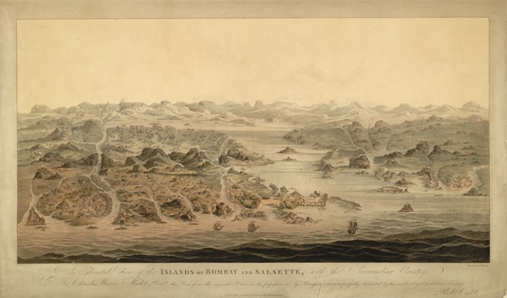
Image: An elevated view of the Islands of Bombay (Mumbai) and Salsette, with the surrounding country in 1803. By J. S. Barth. Source: The British Library Board.
Notes: The image is for reference purposes only.
The report (re)emphasises that the city of Mumbai should be analysed as a ‘coastal city’ built mostly on the reclamation land during the British colonial rule, which was earlier an archipelago of seven islands. Indeed, excess rainfall is one of the critical components; however, it is essential to understand that in the initial phase of the Indian monsoon Mumbai does receive high precipitation.
Water sensitive urban design
Harish Iyer, in his newspaper article published in 2017, discusses the heavy rainfall and waterlogging problems from 2005 to 2017 in Mumbai city. Iyer compares the ‘flood’ disaster in Assam and Bihar state with the ‘waterlogging’ problems of Mumbai city. Many parts of Bihar and Assam state were submerged when the enormous amount of excess water from rivers and lakes was overflown after the heavy downpour. However, he warns us that what happened in Mumbai city was not a ‘flood’. Instead, it was a severe waterlogging problem that resulted after the cloudburst in 2005 and downpour events in short durations in 2017. Iyer points out the failure of the effective storm drain system, polluted rivers and loss of mangroves aggravated the situation in Mumbai. Mitashi Singh and Varnika Upmanyu in an online article published in 2019, further develop Iyer’s proposition and tag the urban floods as a ‘misnomer’ term. The authors recognise the climate change factor; however, stress the ‘water sensitive urban design’ and effective urban planning and implementation to tackle the deluge calamities.
Donthi Narasimha Reddy, in an online news article, discusses a wide range of topics to understand the plausible reasons behind the flooding in the city of Hyderabad. Based on his investigation, he points out that regardless of the quantum of rainfall, the city cripples with routine flooding. He further argues that land-use changes and growing impervious surfaces increase the stormwater and add massive pressure on the drainage. In this background, it become necessary to revisit the intricate drainage patterns of Indian cities.
Drying up of water bodies and shrinking wetlands
According to the Census of India 2011, more than 31 per cent of India was urbanised, and the Ministry of Urban Development has estimated that the rate of urbanisation will increase to 60 per cent by 2050. The Urban flooding document of 2017 prepared by the Ministry of Urban Development, points out the exaggerated phase of spatial expansion of urban extents have magnified the flood risk. Researchers and environmental experts have extensively argued about the negligence of urban water bodies and wetlands in the context of recurring floods in urban cities. The unplanned and rapid growth of urban areas has severely disturbed the catchment areas and their natural drainage features which causes heavy runoff. Compared to the open spaces, impervious urban areas have around 85 per cent of rainfall turning into a runoff. Furthermore, the rise in a built-up area, decreasing pervious surfaces, paving of open space accelerate the waterlogging problems. In the last five decades, the urban wetlands of India are shrunk to around 30 per cent. The decline of wetlands, water bodies, and open space is not limited to any city or region of India. More than 3,000 hectares of wetlands in Hyderabad city have been extinct in the last 12 years. In Bengaluru city, more than 45 per cent of lakes were extinct between 1970 to 2010, and around 72 per cent of lakes have lost their catchment areas.
The ‘Chennai Floods 2015’ report discusses the several reasons for flooding and repetitively underlines the impact of rapid urban expansion, decline of water bodies and defective drainage systems. In the report, it is argued that unplanned urban expansion and encroachment has affected and reduced the water holding capacity of these water bodies. As an example, the report states the construction of Chennai Airport’s runway on the flood basin of the Adyar river, which hampered the natural flow of water. In December 2015, after the heavy rain, water was released from the reservoir which caused the inundation of the airport and its neighbourhood areas. The report mentions the expansion of urban areas in unsustainable ways which significantly alters the hydrological cycle. Chennai city’s land surface is a flat coastal plain and to control the flood it needs an effective drainage system. In Chennai, the total number of stormwater drains are far less than the existing length of urban roads, which essentially makes the city vulnerable to torrential rain. New urban settlements lack efficient and proper drainage facilities, and often the polluted water flows into open storm drainage.
Land and water separation
In India, water bodies are recorded as municipal assets in the ‘Municipal Land Use’ records. The urban water bodies and their proprietorship is one of the contested issues and causes of complex litigations. Multiple agencies like revenue department, urban development, municipal corporations categorically emphasise the ownership of all forms of water bodies remains with these agencies. The studies conducted by the Centre for Science and Environment in 2016, highlights that data of the total number of water bodies is not available and only a few municipal bodies have a statistic of water bodies. Additionally, the research work also argued that rapid urbanisation and changes in land use would be sustained if the water bodies are ecologically preserved and protected.
The reasons behind the decline of wetlands and urban water bodies and catchment areas in Indian cities were primarily investigated and chiefly asserted in the post-independent uncontrolled urban growth and expansion, coupled with the other complex outcomes of land use. The critical scholarship on the study of draining, declining and extinct of many water bodies and catchment areas has disregarded the emergence of colonial discourse founded mainly on the notion of ‘dry’ cities. This overriding discourse played a crucial role in the reclamation of water tanks by delinking the network of rivers, seasonal streams, ponds, and their catchment areas. As a result, the functional water bodies gradually turned into the ‘containers’ that merely hold the water and are vulnerable to pollution.
As the East India Company marched in the vast and fertile floodplains of River Ganga and its tributaries, the main challenge was posed by the seasonal floods. The rising water level of rivers was an unwelcome guest. The inundations restrict the movement of the troops and posed threat to the safety of the colonial officers and soldiers.
Thus, the tool and measures of ‘controlling the flood’ become necessary. The dry solid ground overrode the wet, moist and unpredictable landscape and intensified the need for more ground to expand. The reclamation of swampy, marshy, non-functional and stagnant water pools, tanks are ‘development’ work that ensured hygiene and safeguarded from infectious diseases and an unsanitary environment. To improve the sanitary conditions of the town under the control of East India Company and later under the British Crown draining of water bodies was considered as the highest priority. The colonial urban imagination and policies that stemmed from Victorian sanitation policies, safety priorities and urge for modernity made an enormous impact on the hydrological system of the Indian subcontinent. The Victorian era of sanitary reforms to control and eradicate the infectious diseases owing to ‘miasma’ draining of water bodies was necessary. Embarking on this so called journey of modernity, the drainage system was built without paying attention to the topography such as slope, low lying areas, embankment etc. of the urban settlements. The arbitrary ‘development’ projects such as combined drainage initiated the river pollution and also contaminated the water bodies.
The increasing number of deaths of British soldiers in India due to cholera, malaria, fever, and the massive setback due to the first war of independence in 1857 alarmed the Crown and British Parliament. These circumstances validated the large-scale implementation of sanitary reforms coupled with civic projects such as the widening of streets, municipal water supply, drainage projects, reclamation of swamps, marshy lands and ditches, etc. The colonial stakeholders primarily worked on the analogy model and imported the theories from home, and implanted those combined with an air of superiority. These ‘urban reforms’ were also calibrated with the strategical importance of the places and picking the most cost-effective solutions. This imperative exercise initiated the separation of land and water and turned the cities from wet to dry.
Entire city as a catchment
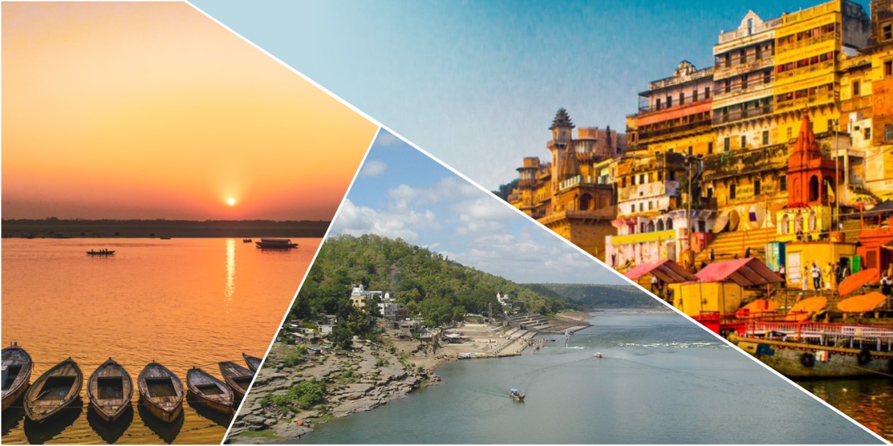
It is important to ask why floods are undesirable. It is principally because of the deficiency of our understanding regarding the flood as a part of the natural system and constantly intruding in flood-prone territories. Uttar Pradesh district gazetteers of Varanasi published in 1965 has an interesting reference on floods. Floods are noted as an ‘annual feature’ of the district. It further states that,
During the floods, which are common and extensive and usually occur in August and September, the velocity of the river often exceeds four miles an hour and its level rises up to about seventeen feet. (p. 9)
Water sensitive urban design, more research and pilot projects on the model of sponge cities, river literacy are some of the areas where we need to focus and improve. I propose the model where we can consider the entire city as a catchment area. The ‘Heritage City Development and Augmentation Yojana’ (HRIDAY) and ‘Smart Cities Mission’ programmes of the Modi government extensively discuss the revival of water bodies and wetlands. Both these mission programmes categorically highlight the heritage and ecological dimensions of water bodies and locate them on the broader gamut of the urban environs. I propose that urban local bodies strive to improve their strategies to handle natural calamities and work on the various emerging models and technologies to make the cities resilient.
(The writer is the Senior Research Fellow, Dr Syama Prasad Mookerjee Research Foundation & Affiliated Researcher at Kyoto University, Japan. Views expressed are personal)